Commercial vehicle AADT: the most accurate estimates at national scale
This heavy-duty truck volume analysis shows how toll pricing differences reshape freight corridor behavior at the US-Canada border.

“Advance eligible truck parking with a clear roadway safety nexus” is the new funding priority for Safe Streets and Roads for All (SS4A), under the Bipartisan Infrastructure Law. Not only did SS4A add this new category in March 2026, but they’ve elevated it by including it on the list of factors that will make grant applications “more competitive,” meaning, more likely to receive funding.
SS4A’s decision to add truck parking as both an eligible category and an explicit competitiveness factor is significant. It lifts truck parking solutions to a new nationwide priority level.
Planners can improve truck safety via a range of project types, from hard infrastructure to technology pilots. What makes a grant application competitive isn’t just identifying a problem; it’s demonstrating precisely where investment will reduce safety risks. Here are six new opportunities to explore for improving truck parking safety in your region, each grounded in the kind of empirical demand evidence that strengthens any grant funding case.
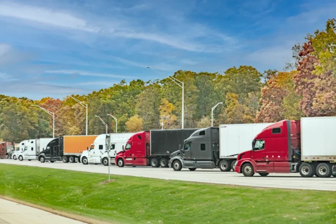
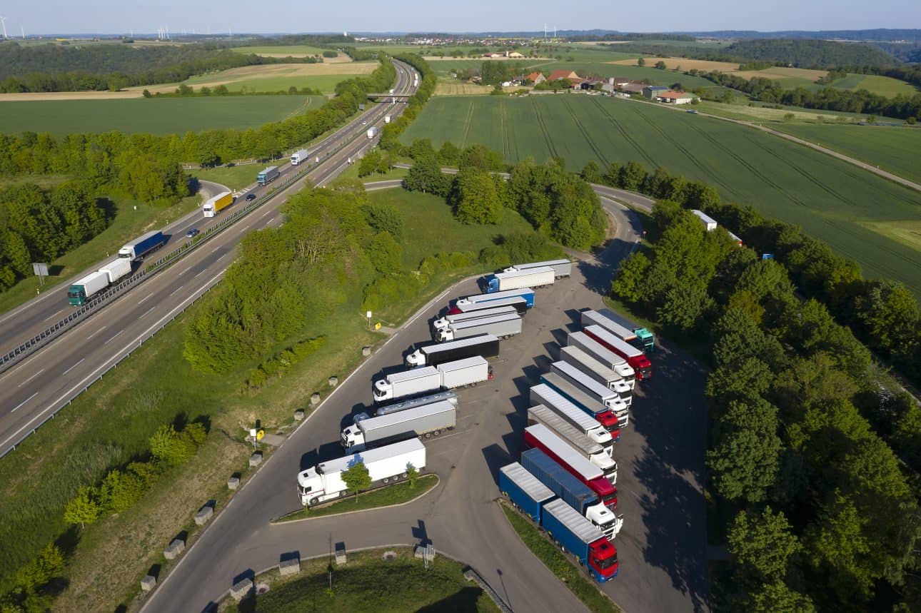
The most direct intervention is also the most fundable: building more spaces where drivers actually need them. Altitude’s recent truck parking report identifies corridors with 5,000 or more annual long-duration ramp parking events as having sufficient demonstrated demand to support new facilities — roughly 14 or more unauthorized overnight stops per day on a given segment. That’s not an estimate or a survey result; it’s observed behavior from real truck movements. For DOTs preparing an SS4A application, this threshold gives you a defensible, data-backed site selection methodology rather than a map drawn from intuition.
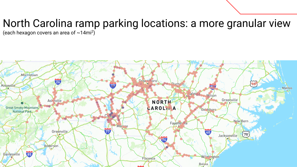
Figure 1: An analysis of North Carolina identifies locations of long-duration (9-12 hours) heavy-duty truck parking events taking place on highway on/off ramps from November 1, 2024 to October 31, 2025.
Not every safety fix requires new land or new construction. Trucks parked overnight on ramps between 8pm and 5am — the peak window identified in the report — create hazards that better lighting and retroreflective delineation can directly mitigate. The Federal Motor Carrier Safety Administration has cited inadequate visibility as a significant contributing factor in crashes involving parked commercial vehicles. Altitude data can identify the specific ramp locations with the highest overnight stop frequency, allowing agencies to target lighting investments at the places where the collision risk is most acute rather than distributing improvements uniformly.
A driver who knows that the next authorized truck stop has open spaces can plan ahead instead of parking on a ramp when the Hours of Service (HOS) limit hits. Real-time availability information systems — variable message signs tied to occupancy sensors at truck parking facilities — have shown promise in pilot deployments as a way to reduce unauthorized parking without adding physical capacity. The time that drivers spend searching for approved parking creates a productivity and safety loss that better information could meaningfully reduce. Altitude’s data on where ramp parking clusters relative to authorized facilities helps agencies identify the signage gaps and decision points where drivers most need guidance.
The report’s journey analysis points to a specific vulnerability: The median trip ending in ramp parking covers 520 miles and lasts 9 hours and 40 minutes — just short of the federal 11-hour HOS driving limit. That predictability is an opportunity. If planners know where drivers on 500-mile journeys from major freight hubs typically exhaust their available drive time, they can place reservation-capable facilities at those mile markers. SS4A funds can support the technology infrastructure — booking systems, signage, connectivity — that enables a managed parking model, and the journey data provides the locational rationale.
Tuesday and Wednesday consistently show the highest ramp parking rates in the dataset, with events peaking between 8pm and midnight. That pattern reflects mid-week freight volume cycles and the schedule pressure that comes with them. When agencies can show that existing rest areas along specific corridors are functionally full during predictable windows — and that trucks spill onto adjacent ramps as a direct result — they have a compelling case for capacity expansion or operational changes like extended access hours. Temporal data from Altitude makes that demonstration concrete and corridor-specific.
Highway ramps are engineered for moving vehicles, not for stationary loads of 80,000 pounds held in place for 9 to 12 hours at a time. The American Society of Civil Engineers has estimated a $684 billion funding shortfall just to bring the U.S. highway system to a state of safe repair — a deficit that unauthorized ramp parking actively worsens. Altitude’s stop data can document the frequency and duration of loading events at specific ramp locations, giving infrastructure agencies a quantified basis for prioritizing rehabilitation investments and connecting pavement safety directly to the SS4A roadway safety nexus.
Agencies best positioned to compete on safety grants are those that can move quickly from identified need to documented demand. A strong application doesn’t just describe a problem — it shows federal reviewers exactly where unsafe parking is happening, when it peaks and how a specific investment will reduce crashes. Whether your priority is new capacity, smarter signage or pavement rehabilitation, telematics-derived truck parking data gives your application the empirical foundation that turns a compelling argument into a funded project.
Ready to move from recognizing the problem to securing infrastructure funding? Download the full truck parking demand analysis to see the corridor-level data you need to justify capacity investments and make meaningful safety gains.
Safe Streets and Roads for All is a federal grant program established under the Bipartisan Infrastructure Law that funds planning and infrastructure projects designed to reduce traffic fatalities and serious injuries. State and local governments, metropolitan planning organizations (MPOs), regional planning organizations and tribal governments are eligible to apply.
Yes. In March 2026, the U.S. Department of Transportation added truck parking as a new eligible project category under SS4A. More significantly, truck parking projects with a clear roadway safety nexus were included on the list of factors that make applications more competitive — meaning agencies that include truck parking investments are more likely to receive funding.
Federal reviewers look for applications that document exactly where unsafe parking is occurring, when demand peaks and how a specific investment will reduce crashes. Applications backed by observed, empirical data — such as telematics-derived stop counts and ramp parking frequency — are stronger than those relying on modeled estimates or anecdotal evidence.
The deadline for the current round of SS4A funding is May 26, 2026.
A strong application should document the location and frequency of unauthorized ramp parking events, the time-of-day and day-of-week patterns that reveal peak demand and the journey characteristics of vehicles stopping — including how far they traveled before stopping and how close authorized facilities are. Altitude by Geotab’s stop analytics provide this corridor-level evidence in a format that supports defensible, site-specific investment decisions.
This heavy-duty truck volume analysis shows how toll pricing differences reshape freight corridor behavior at the US-Canada border.
This heavy-duty truck volume analysis shows how toll pricing differences reshape freight corridor behavior at the US-Canada border.
Altitude by Geotab and CATT Lab bring Stop Analytics into RITIS, giving DOTs and MPOs access to observed truck stop data from 6 million commercial vehicles.