
3 freight metrics that improve truck traffic forecasting for state DOTs
State DOTs can forecast truck traffic earlier by watching freight metrics from city and port data. Here are 3 signals worth tracking.


ATLANTA, GA — (September 22, 2026) — Altitude by Geotab, a leading mobility insights platform, today announced a new four-year statewide contract with the Tennessee Department of Transportation (TDOT). Through this agreement, TDOT gains complete access to Altitude’s comprehensive suite of transportation data analytics modules, providing high-resolution, commercial-vehicle-specific mobility insights to inform statewide travel modeling, freight movement planning, and infrastructure modernization.
Procured through the Eastern Transportation Coalition (TETC), the contract reinforces TDOT’s commitment to utilizing cutting-edge data solutions for state transportation network design. The agreement grants TDOT access to Altitude’s full portfolio of analytics tools like:
This follows a recent announcement by Geotab, highlighting TDOT’s adoption of fleet management technology across its operational state vehicles. Showcasing the expanding depth and breadth of Geotab’s trusted relationship with the State of Tennessee across both fleet operational management and big-data transportation planning.
“Modernizing Tennessee’s transportation infrastructure requires precise, real-world data on commercial freight movements and traffic patterns across our key corridors,” said Dan Pallme, Director of Passenger Transportation, Rail, and Freight at the Tennessee Department of Transportation. “Altitude by Geotab delivers commercial vehicle origin-destination matrices, truck parking demand analytics, and corridor flow data at a level of granularity that will significantly enhance our Travel Demand Model calibration, freight bottleneck mitigation, and strategic corridor planning across the state.”
TDOT will deploy Altitude’s granular analytics to resolve critical data gaps left by traditional travel survey sources, enabling data-backed decision-making on high-priority infrastructure initiatives, including:
With this agreement, Altitude by Geotab continues to grow as a trusted transportation analytics platform for state DOTs and regional MPOs nationwide.
About Altitude by Geotab
Altitude by Geotab, a line of business within Geotab, is a leading provider of advanced mobility insights and solutions for public and commercial sectors across North America. Headquartered in Oakville, Ontario and Atlanta, Georgia, we leverage our expertise in data analytics to help decision-makers gain a comprehensive understanding of road network movements. By delivering reliable and contextualized insights, we enable improved planning capabilities and better financial outcomes, while maintaining data confidentiality and privacy. Our solutions drive safer, more efficient and more sustainable mobility throughout North America. Learn more at altitude.geotab.com and follow us on LinkedIn.
Altitude by Geotab is a trademark or registered trademark of Geotab Inc.
State DOTs can forecast truck traffic earlier by watching freight metrics from city and port data. Here are 3 signals worth tracking.
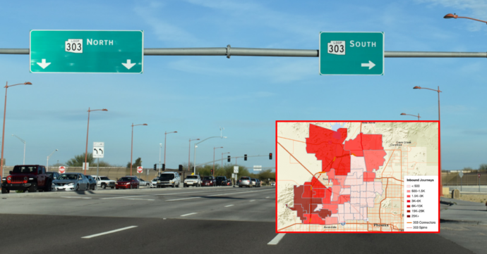
How warehouse cluster growth is changing truck traffic near Phoenix’s Loop 303 — freight O-D data on leakage, exit ramp load and vocation mix shifts.
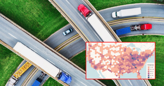
Discover what truck parking data is available for transportation agencies, from journey thresholds to peak demand hours, to prioritize corridors and strengthen funding requests.