A freight planning tool can play an invaluable role in helping you maintain fluid and efficient transportation throughout your region. By leveraging a solution for freight planning and closely working with the companies that regularly move freight in your region, you can work toward smarter commercial vehicle movement overall and develop safer, more reliable transportation networks for all motorists.
What is a freight planning tool?
A freight planning tool is any solution that makes it easier to study commercial vehicle activity and develop new data-driven policies, infrastructure or traffic plans to enhance supply chain movement. Several freight planning tool examples include transportation analytics platforms, logistics optimization applications and traffic routing systems. In this blog post, we’ll focus primarily on transportation data freight planning tools. We’ll address how these technologies can help your department analyze current commercial vehicle movement patterns, identify potential supply chain inefficiencies and create well-researched solutions, all with the support of real-world traffic insights.
How is a freight planning tool used?
Using a freight planning tool, you can simplify the process of developing and updating your state freight plan with the power of data. Freight planning solutions, such as a transportation analytics platform, make strategizing easier by helping to surface transportation inefficiencies and guiding your action plans to solve them. Below, we’ve provided several impactful use cases of a transportation analytics solution.
Smarter regional freight planning and modeling: Analyzing real-world, aggregated commercial vehicle data using a freight planning tool can help you accurately forecast future mobility trends. With the backing of these insights, you can plan effective freight strategies that account for increases in commercial vehicle volumes. For example, the Southern California Association of Governments (SCAG) was able to use Origin & Destination data from Altitude, our turnkey transportation analytics platform, to enhance their transportation models and develop better freight policies.
Traffic analyses and mitigation strategies: Regular bottlenecks of traffic are much more than just an annoyance all motorists must deal with; they can dramatically affect the fate of a delivery deadline for commercial drivers. Freight planning solutions can help your department mitigate road congestion and its effects on goods movement by highlighting key areas where bottlenecks most frequently occur. By surfacing the most common road segments where traffic poses a problem, you can create highly targeted intervention strategies to help reduce clotting.
Advancing road safety initiatives: Harsh driving can raise the risk of all motorists who share a stretch of roadway being involved in a collision, including commercial drivers. Turn angle sharpness, speed limits, regional weather trends and aforementioned traffic patterns can all have a marked impact on the number of harsh driving events recorded, leading to greater safety hazards. Using a freight solution like a mobility insights platform, you can study where harsh driving behaviors are most commonly happening in your region and develop new policies or infrastructure to help curb them.
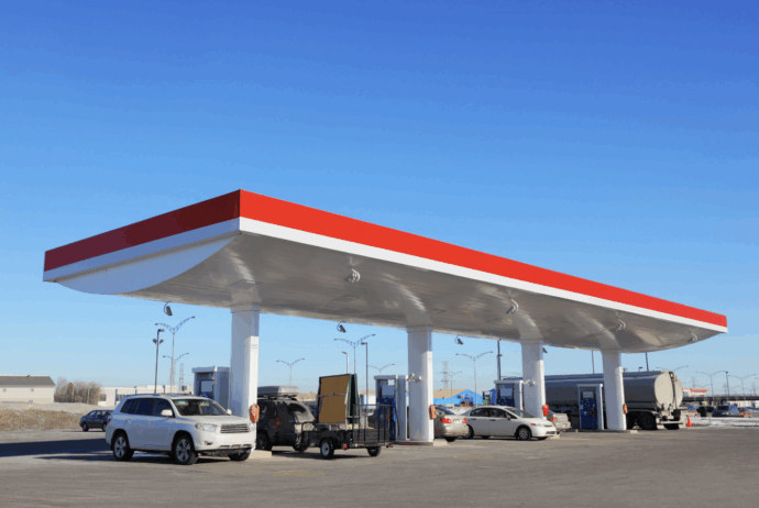
Truck parking and rest area construction: For truck drivers to maintain hours of service (HOS) compliance, they must have a wealth of options to stop and take their required breaks at. This means that in order for departments like yours to optimize truck parking and rest area availability, it’s not strictly the number of spots available that matters. Where they are placed is also essential for smooth and compliant goods movement. By using commercial vehicle insights to guide where new commercial parking areas and rest stops should be built, you can find the best places for new trucker amenities and position them for high usage. Foster safer, more efficient commercial movement with data-driven truck parking initiatives.
Strategic site selection: Choosing the right spot for new infrastructure extends beyond just truck parking areas. Freight analytics tools can also help with pinpointing where fuel stations, electric vehicle charging stations and new warehouses will go. For warehousing and logistics companies, choosing new warehouse locations can prove crucial for staging optimization. Additionally, you can help your region make critical progress toward sustainability goals with smartly placed electric vehicle (EV) charging stations. For both businesses and government transportation agencies, freight planning solutions are able to help them work together to achieve their strategic objectives.
Keen results measurement: Over time, you’ll want to study the impact of your data-driven policy or infrastructure decisions. Freight planning tools are able to help you see if your freight planning strategies are achieving their desired results, or if more adjustments are required. Closely monitoring historical transportation analytics both before and after a new strategy takes effect will help you easily track improvement, negative impacts or stagnation. This monitoring and measurement process can be further enhanced by using a highway performance monitoring system (HPMS) in tandem with annual average daily traffic (AADT) data. By gaining a holistic view of commercial vehicle movement in this way, you can easily study changes over time and refine your transportation strategies.
What are the benefits of a freight planning tool?
From these examples, it’s evident that freight planning tools can exponentially elevate your planning and modeling capabilities. As a result of using them to guide your state freight strategy, you can:
- Spot problem areas in your region’s commercial movement more easily
- Increase the safety and accessibility of your transportation network for all road users
- Reduce delivery delays and streamline supply chain efficiency
- Achieve greater economic prosperity and create more jobs in transportation
- Improve your region’s resiliency and ability to manage emergency recovery efforts
- Boost regional sustainability by satisfying growing demand for commercial EV charging stations
What should I look for in a freight planning tool?
Whether you’re a business or a department of transportation, there’s no doubt that a freight analytics platform can be a powerful addition to your planning toolkit. However, there are several crucial factors to consider as you seek out a platform to help you develop a comprehensive state freight plan. Find a solution that will check every box using these key considerations.
Reliable, privacy-safe data
When making potentially multi-million dollar transportation decisions, the last thing you’d want to do is leave the quality of the data you’re using to chance. You’ll want a transportation analytics provider that offers ultra reliable first-party insights, as well as one that vets the accuracy of its data. Look for providers with first-party, anonymized data that aligns with federal standards.
For example, Altitude by Geotab is the primary source and processor of our data. Our analytics are all provided in aggregate, so you can be assured that you’re using real-world, actionable intel to guide your transportation decisions (unlike survey or simulation-based transportation modeling software). Altitude’s data is derived from our vehicle pool of four million commercial vehicles and anonymized, meaning they’re reliably sourced analytics you can count on. Altitude’s unique Expansion Factors methodology also enables us to take snapshots of our commercial vehicle insights and accurately extrapolate them to be representative of all commercial totals within a region.
We additionally compare our data against vehicle ground truths reported by the Federal Highway Administration (FHWA) to verify their accuracy. At Altitude by Geotab, we know that in order for our analytics to be used for funding applications and federally-compliant freight plans, they must be free of personally identifiable information (PII) and remain aligned with BIL/NHFP mandates. We follow a number of protocols to protect the information of our customers (detailed in our Digital Privacy and Trust Pact) while providing you with reliable, granular insights. Use our platform to study privacy-safe transportation data, maintain compliance and make smarter freight planning decisions.
Context-rich traffic insights
In the realm of freight planning, context is essential. Effective freight planning tools enable you to distinguish between vehicle classes, vocations and fuel types. Contextual information like this can help you infer why certain vehicles follow distinct movement patterns or what their purposes are. While many freight planning tools offer surface-level insights, they may stop short of offering detailed contextual insights like vehicle vocations, classes and types. Observing what routes specific commercial vehicles are taking and what their stopping behaviors are allows you to create highly targeted solutions for the challenges affecting your region’s roads.
Altitude offers an assortment of contextualized transportation factors that make understanding the raw insights easier. In addition to our insights being segmentable by vocation, type and class, they’re also available by industry and fuel type. No matter the goals of your state freight plan, you can parse the data to suit your strategic objective. When surveying current parking deficiencies, Altitude even goes a step further than just providing vehicle stopping behaviors alone by offering real parking demand insights like Hourly Parked Events. These deeper analytics help you arrive at more accurate conclusions by reporting exactly what’s occurring and nothing arbitrary: No assumptions; just observed behaviors.
Extensive geographic and modal breadth
When looking for a transportation analytics platform, another important consideration is how rich the datasets it provides are. How granular and extensive are its insights? Your tool should span broad sets of roads and freight modes, because when it comes to making critical infrastructure or policy decisions, the more detailed the insights are, the better. Consider key points such as a transportation data solution’s coverage of primary, secondary and tertiary roadways, what regions it covers and how scalable it is. Can the solution also scale with the evolving needs of your state freight plan?
Altitude by Geotab’s insights offer comprehensive visibility into traffic bottlenecks, corridors and freight flows, extending to 99.9% of primary roadways and 93.7% of secondary and residential roadways in North America. Our platform’s scalability and flexibility make it ideal for state freight planning, offering a future-proof solution that delves deep into the transportation trends that characterize your region. For a freight planning solution that’s equipped with the level of granularity your agency needs, choose Altitude.
A platform with fast, visual and actionable dashboards
Keeping pace with the rapid development of new transportation technologies is critical for successful freight planning. In turn, you should search for platforms with configurable dashboards and APIs that let users filter through, explore and share insights quickly. It’s important to have a transportation analytics tool that is free of complexity and can help you quickly diagnose areas to improve your regional transportation network. From the origins and destinations of aggregated commercial vehicle movement to stop behaviors and total volumes, make sure your solution is responsive and highly customizable to your department’s needs.
For example, Altitude’s intuitive dashboards turn intricate freight data into clear, usable insights and can be configured to your preferences. It’s an all-in-one analytics platform that’s built for the unique challenges that today’s transportation planners face. Our platform makes it easy to uncover and dissect inefficiencies in your transportation network, then take prompt action. Whether you choose to surface insights using its user-friendly UI or integrate them via APIs into a partner platform, you’re in pole position for better state freight planning.
Several essential questions to ask when selecting a freight planning solution
Before selecting which freight planning solution will work most effectively for your goals, you should create a checklist of relevant questions to go through. Doing so will help you identify the most essential capabilities required to support your state freight plan and visualize a clear path to success. Below, we’ve compiled several of the most important questions to ask while evaluating the freight planning tool marketplace:
- Will this solution represent a strong usage of my organization’s budget?
- How specifically will this tool help me advance my state or region’s freight plan?
- Does the data it provides focus exclusively on commercial vehicle activity?
- Is it easy to derive actionable insights from the data?
- Are the insights presented in an anonymized, aggregated format that maintains compliance with federal requirements?
- How expansive is the platform’s window of coverage?
- Will this platform consolidate any of the data my organization regularly analyzes and make it easier to study?
Altitude: The ultimate mobility insights solution for all your freight planning needs
For a truly end-to-end freight planning tool that is designed for the rigors of modern transportation planning, Altitude is the answer. Our tested and reliable platform cuts through irrelevant datasets, allowing you to drive straight to the source of your region’s transportation challenges and solve them with precision. As your region evolves over time, use our solution to uncover new opportunities for improvement and develop data-driven interventions. Tackle current and future transportation challenges head-on with the power of our platform.
Start optimizing your freight movement initiatives today with Altitude. Speak with a solutions expert to learn more.