We closely follow new and emerging privacy laws like Maryland’s Online Data Privacy Act (MODPA), which becomes law on October 3. But at Altitude, privacy protection isn’t a response to new laws, it’s the foundation our platform was built on. Altitude by Geotab is built on Privacy by Design architecture has been exceeding these standards since day one.
We follow all regional privacy laws and data privacy best practices when it comes to handling customer data, and our partners and employees must also take regular security training to maintain compliance. Altitude is tightly integrated with Geotab’s legal, privacy and compliance teams, and all major decisions are governed by an Enterprise Data & AI Risk Committee that meets quarterly.
Because data privacy is so important to us, we are transparent about our data practices. Here, we answer the most common data privacy related questions we receive.
Where do you get your data?
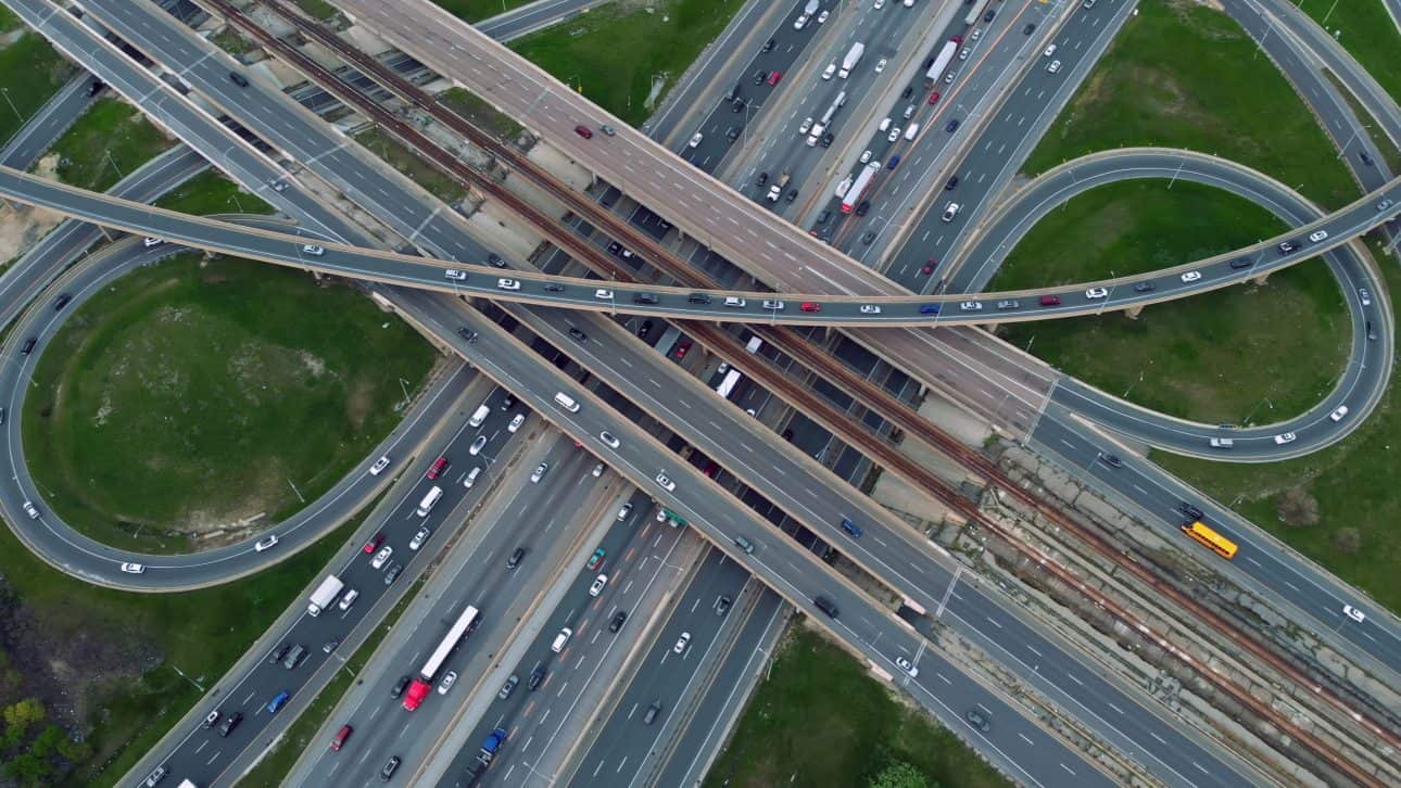
Geotab is the source of the Altitude data. We source our insights from over five million commercial vehicles, 26 million trips a day and over 190 million miles driven each day. Our insights are gathered from a collection of Geotab telemetry hardware and original equipment manufacturer (OEM) solutions. This means that we know our data intimately.
This first-party, commercial-only approach differs fundamentally from providers using mobile app data, synthetic models, or mixed consumer-commercial datasets. We don’t infer truck movements from cell phone signals or blend personal vehicle trips with commercial traffic. This eliminates entire categories of privacy risk.
We have built privacy layers that allow data innovation and create valuable insights while reducing unintended consequences (e.g. uncovering insights about business operations of public or private locations).
How is that data protected?
We surface road-level insights only after a layer of Personally Identifiable Information (PII)-safe, privacy-by-design processing. This processing layer aggregates and suppresses identifiable data before analysis even begins.
At Altitude, our PII-Safe Layer applies minimum-count thresholds, spatial/temporal aggregation, and automatic suppression. Our FedRAMP, FIPS 140-2, and ISO 27001 certifications validate these practices.
This layer has sophisticated algorithms and machine learning models which automate the exclusion of identifiable elements — such as activities that occur in residential areas for extended periods of time. This automation helps protect the privacy of commercial drivers while maintaining the quality and accuracy of the data insights. Every query to our platform must pass through this layer – there is no bypass mechanism, even for internal users.
What’s the difference between privacy-by-design and privacy-by-policy?
Privacy-by-design means that privacy protection is built into our technical architecture and is impossible to bypass. Privacy-by-policy means relying on rules and procedures that could potentially be overridden. At Altitude, you can’t access individual vehicle data even with admin credentials because it’s aggregated before it enters our system.
How to tell the difference? Ask the vendor, “Can your internal team access individual vehicle records if needed?? If the answer is yes, they’re using privacy-by-policy, not privacy-by-design.
How can I verify your privacy claims?
Unlike black-box solutions, Altitude provides transparent methodology documentation. You can review our technical architecture, see our certifications (FedRAMP, FIPS 140-2, ISO 27001), and, most importantly, test it yourself.
Go ahead, try requesting individual vehicle data through our API. You’ll get an error notification because that data literally doesn’t exist in our system. Many providers claim privacy compliance, but few can demonstrate technical impossibility of privacy violations.
Do you track specific vehicles or drivers?
No, we actually can’t. Our PII-safe layer anonymizes and aggregates the data before analysis begins, so individual vehicles/drivers are never identifiable and can’t be re-identified during or after analysis.
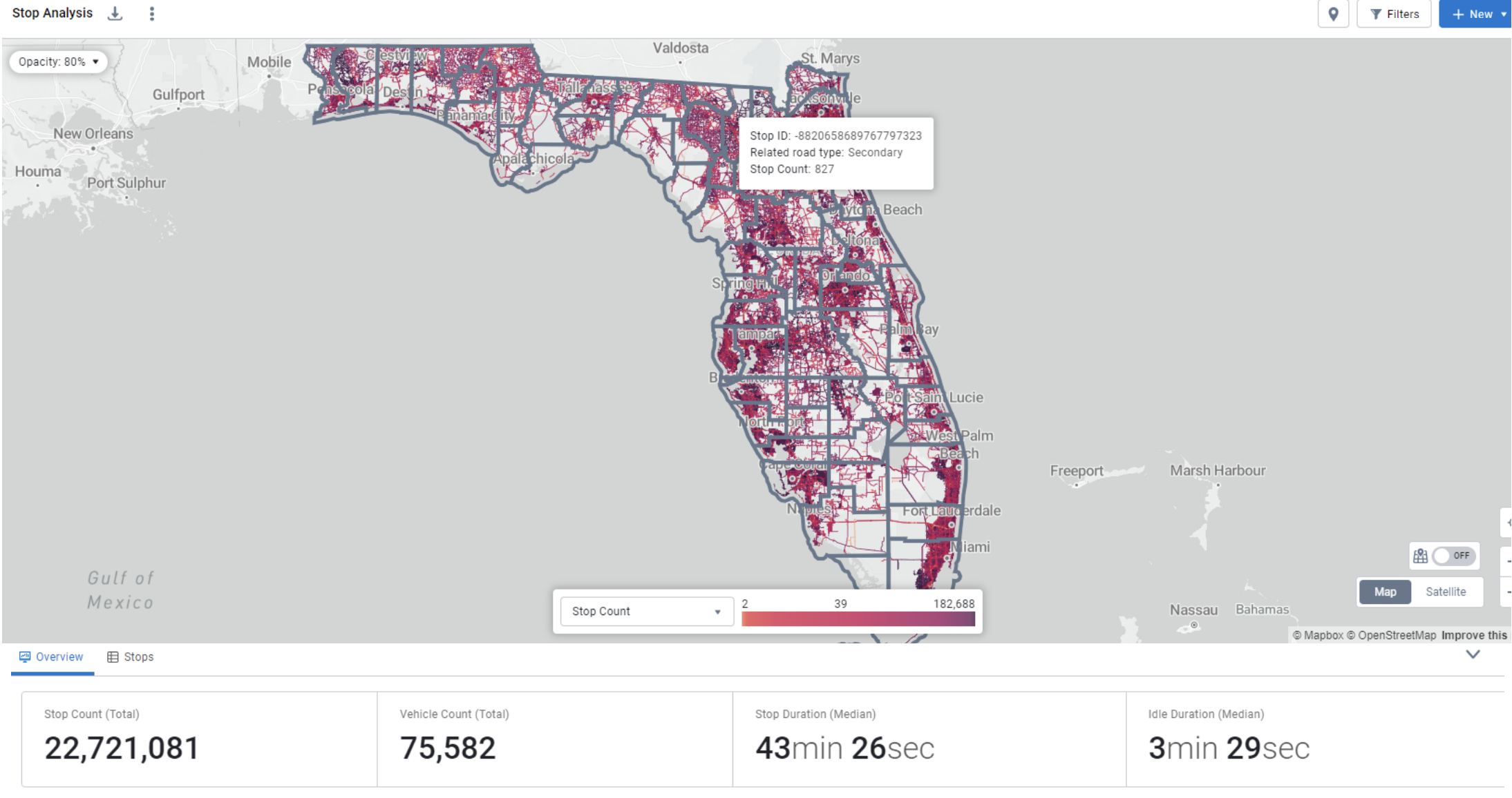
Figure 1: Screenshot of Altitude interface showing the ‘Commercial Vehicles Only’ data”
The system performs several key obfuscations:
- Obscuring vehicle VINs
- Geospatial obfuscation to protect vehicle drivers’ residence location
- VINs hashed to provide a unique and consistent identifier for a vehicle without using the real VIN
- Treated (“salted”) prior to hashing to avoid vulnerability from hash-matching attacks
This is intentional as part of our Privacy by Design strategy. We support planning, not monitoring.
Do you sell fleet-specific data?
No, because we can’t break out any information by PII criteria. Altitude by Geotab provides aggregated, anonymized commercial movement insights with minimum-count thresholds and PII data suppression. No identifiable fleet, vehicle, driver, or customer information is exposed or sold. Put simply, we publish planning-grade insights at geographic/corridor levels, not fleet-specific data.
For example, when a State DOT analyzes truck traffic for HPMS reporting, Altitude automatically ensures no individual trucking company can be identified, while still providing accurate commercial AADT by vehicle class.
This architectural design choice means privacy protection isn’t optional or configurable – it’s enforced at the system level for every single query.
What is data coverage like with the Altitude platform?
Altitude reflects observed commercial movement across the U.S. and Canada, derived from a first-party network derived from millions of commercial vehicles. Coverage varies by region, roadway type and time period; on primary roads coverage is about 99.9%. Insights are granular and contextualized (segmentable by vehicle class, vocation, fuel type and industry) and are reported only in aggregate at geographic levels, providing context beyond simple traffic counts. The platform maintains about two years of historical coverage (module-dependent) and is refreshed on an up-to-date cadence.
Some providers claim higher coverage by including inferred or modeled data, but this introduces both accuracy and privacy concerns. Our 99.9% coverage on primary roads comes from actual observed commercial vehicles, not statistical projections or consumer device extrapolation.
Despite this comprehensive coverage, our privacy protections ensure that increased data density never compromises individual vehicle anonymity. More data actually strengthens our aggregation thresholds.
Geolocation privacy data at every stage
Altitude by Geotab’s commitment to safeguarding client confidentiality and privacy is unwavering. Our comprehensive privacy program, strict data policies, and ongoing training ensure that all employees uphold the highest standards of data protection. The integration of legal, privacy and compliance teams in all major decisions further reinforces our commitment to responsible data handling.
By prioritizing privacy and security at every stage of the data journey, Altitude by Geotab empowers customers to trust that their data is safe and confidential. As advancements in AI and data analytics continue to reshape industries, we remain committed to setting the standard for responsible data stewardship, empowering businesses to harness the power of data while upholding the highest ethical principles.
To learn more about how we convert data into mobility insights responsibly, get our eBook or join us Thursday, October 30th at 1:00pm ET for our panel webinar “Big data that delivers: Accuracy, governance, and agency best practices“.