Atlanta, GA (May 15, 2025) – As nearly 9 in 10 companies report changes to their supply chains, many stakeholders across North America are watching border crossings and port traffic for signs of trade disruption. Altitude by Geotab’s Tariff Trend Tracker offers daily and weekly data insights into U.S.-Canada commercial freight traffic amid ongoing tariff discussions.
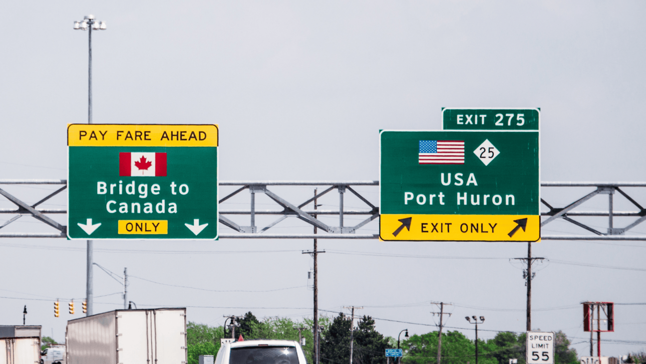
The recently launched Tariff Trend Tracker uses anonymized data from one of the industries largest connected vehicle datasets to provide an aggregate view of commercial vehicle movement across major bridge crossings (Ambassador Bridge, Blue Water Bridge, Montreal to New York, Peace Bridge, and Vancouver) and key ports (Los Angeles and Long Beach; Oakland; Seattle and Vancouver). Updated with key insights on a weekly basis, the Tariff Trend Tracker highlights cross-border transportation volumes, offering a unique, data-driven perspective on the impact of tariffs and other variables.

Weekly percent change from avg for heavy-duty vehicles by border crossing

Weekly percent change from average for heavy duty vehicles by port
Altitude’s analysis of major border crossings throughout late 2024 and early 2025 shows that while widespread discussion about tariffs raised concerns, actual commercial vehicle volumes showed some localized shifts, indicating minor variations rather than considerable fluctuations across different border crossings and port locations. This highlights the complexity of isolating tariff effects from other variables, such as infrastructure projects like the Blue Water Bridge construction or toll adjustments like on the Ambassador Bridge and underscores the need for nuanced, data-driven analysis.
Nate Veeh, AVP of Market Development at Altitude by Geotab, emphasized, “Businesses are feeling the pressure from policy shifts and headlines but when you look at the data, we are seeing a more nuanced story. Our tracker tool channels contextualized insights from Altitude, allowing us to keep our finger on the pulse of all cross-border freight and commercial fleet activity. It allows stakeholders to move beyond speculation and make informed decisions based on real-world evidence.”
The Border Freight Traffic versus Tariffs Impact Trend Tracker provides:
- Timely data and trends: Offers insights on a weekly basis into trade flow changes, unlike traditional reports.
- A unique source: Leverages one of the largest commercial telematics datasets available.
- Quantifiable impact: Provides stakeholders with a valuable baseline for comparison as the situation evolves.
- Context: Provides valuable context for businesses involved in cross-border trade, logistics companies managing supply chains, and policymakers evaluating trade regulations.
“This is another tool that can bring additional insight to a very changing and complex environment,” said Veeh. “Trends over time can allow planners, fleet operators, and other stakeholders to monitor and react to real data and make necessary adjustments to their business models. We believe that our data and data insights can inform the transportation and commercial freight industry.”
For more information, please visit: https://altitude.geotab.com/news-and-releases/border-tariff-tracker/