
8 ways DOTs use stop analytics data for truck parking planning
Truck parking planning made data-driven: Learn how DOTs use stop analytics to identify hot spots, justify funding and prioritize corridors.

During this Connect presentation, we highlighted how Altitude by Geotab data integrates with the LOCUS Truck platform, adding value for organizations that are looking to develop better commercial transportation strategies and state freight plans.
In “Influencing the Future of State Freight Plans,” Dan Andersen, Principal Practice Lead at Cambridge Systematics spoke about how to get the best data for state freight planning by leveraging the capabilities of the LOCUS platform and Altitude by Geotab’s contextual insights. Dan showcased the potential of LOCUS for studying freight movement and keeping users informed via Altitude by Geotab’s integrated contextualized insights. The session provided glimpses of how transportation data as a whole can be harnessed to enhance truck parking and electric vehicle (EV) charging infrastructure on a state-by-state basis.
States must develop strategic freight management plans every four years, as mandated by the U.S. Department of Transportation. Their plans must factor in 17 different requirements, including but not limited to current trends, truck parking assessments, supply chains, multi-state compacts and delay mitigation strategies. States are provided funding from the federal government in exchange for the submission of a comprehensive freight strategy that assesses all 17 of the requirements and includes plans for how the funds will be used.
In this session, Dan highlighted how Cambridge Systematics helps bridge the data gap that state departments need to develop a suitable freight management strategy. Since 1972, Cambridge Systems has innovated solutions that enable organizations to easily make sense of intricate vehicle insights, helping them create smarter, more efficient transportation plans. With the development of their freight planning and analytics tool, LOCUS Truck, Cambridge Systematics allows departments to visualize holistic transportation data and study the functionality of existing transportation networks. LOCUS Truck was created using Altitude by Geotab’s extensive commercial vehicle dataset, equipping the platform with the latest and most accurate insights available.
The use of this data within LOCUS Truck is instrumental in planners’ ideas to build smarter interregional road systems. Deep insights about vehicle travel, vehicle types and parking trends help organizations lay the foundations of their freight movement strategies by providing them with accurate, tangible figures that indicate areas of improvement in the grid. Once states have used these insights to assess their region’s transportation network, they can begin installing new transportation infrastructure solutions to remedy any inefficiencies indicated by the data.
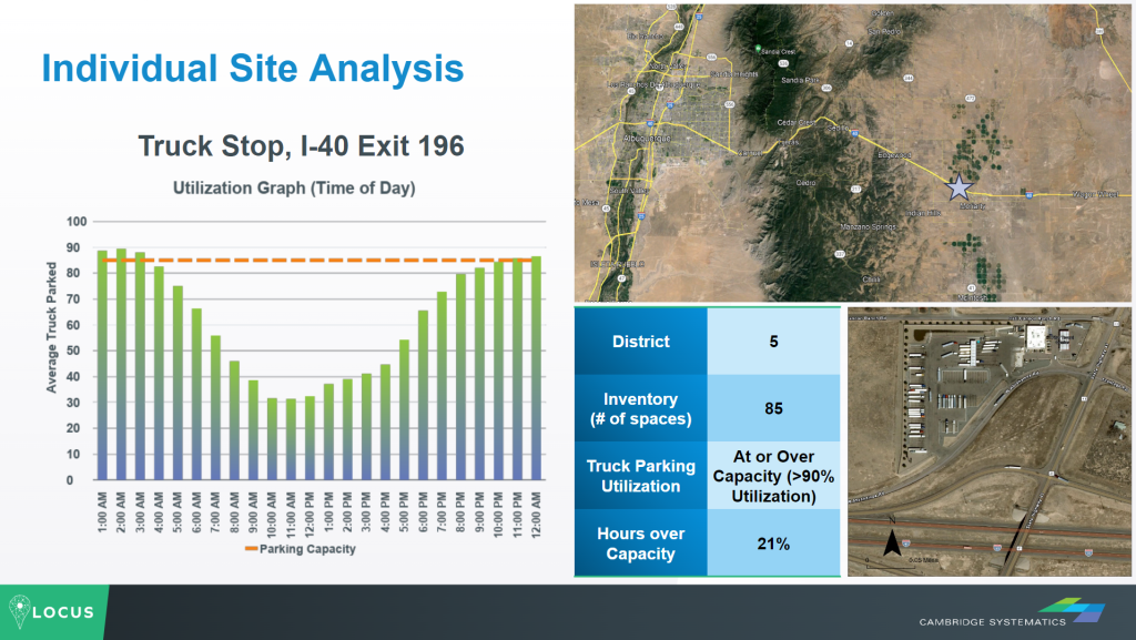
The presentation also provided an intriguing use case for truck parking data in the state of New Mexico. By studying current public and commercial parking lots, setting up zones and integrating Altitude by Geotab data within LOCUS Truck, leaders can gain a solid understanding of where current parking infrastructure stands.
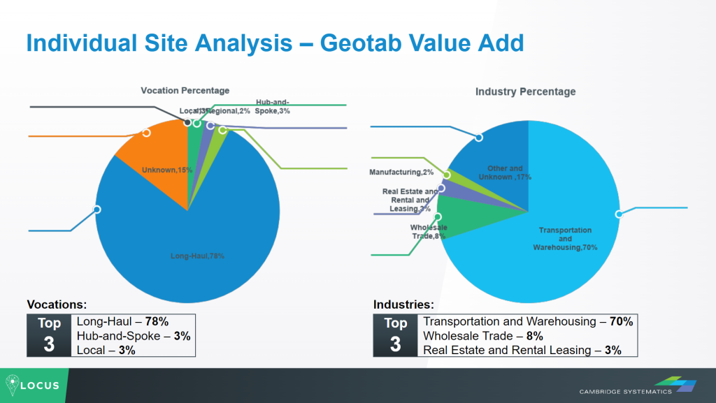
With LOCUS Truck’s advanced insights, planners are also able to view metrics on a site-by-site basis, allowing them to see when the busiest times of the day are for parking, typical capacity limits and what industries or vocations the vehicles are usually associated with. Stop time distributions are another valuable metric that indicate how long vehicles are typically at rest and how trips are most commonly broken up. Using this information, state officials in New Mexico can visualize the best areas for new heavy-duty truck lots.
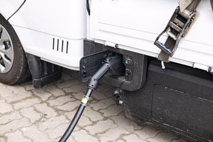
In addition to creating better truck parking opportunities, it’s also important for states to build more EV charging infrastructure. Given the recent interest in sustainability and commercial fleets going electric, Dan took time to highlight how vehicle movement data can be used in identifying choice opportunities for corridor electrification.
Increasing the number of vehicle charging stations helps encourage more companies to electrify their commercial fleets. In the state of Colorado, another use case was presented that demonstrated how origin and destination data could be leveraged during the selection process of new public charging locations. These would be needed to support in-state businesses making “middle mile” trips that want to convert their fleets to electric trucks. From the Denver metropolitan area northward to Fort Collins and southward to Colorado Springs, counties in between were found to regularly see vehicle trips in the 75-125 mile range before having minimum stop times of eight hours. Similar findings were also discovered along the northeast corridor from Grand Junction toward Rifle and Glenwood Springs.
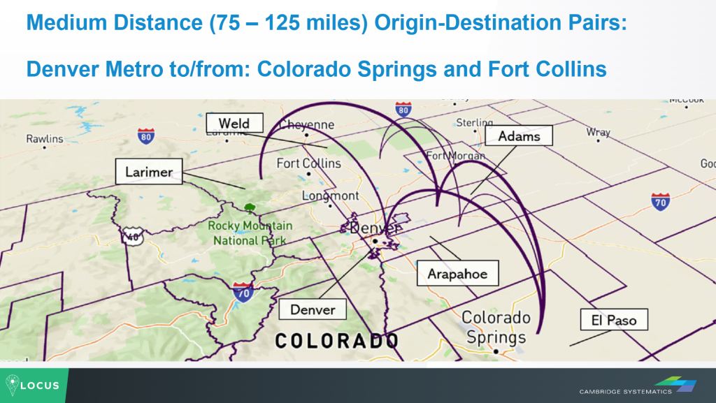
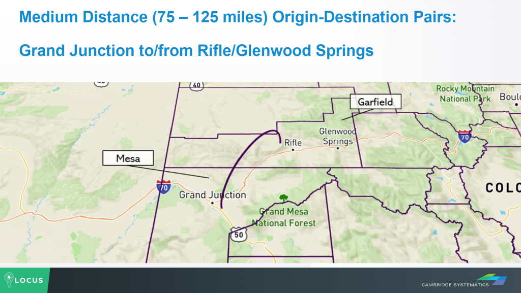
This data indicated that along the I-70 and I-25 corridors that see the heaviest freight traffic in Colorado, substantial opportunities exist to implement new EV charging stations. By building these new kinds of infrastructure, the state of Colorado can position their cities to support greener freight movement.
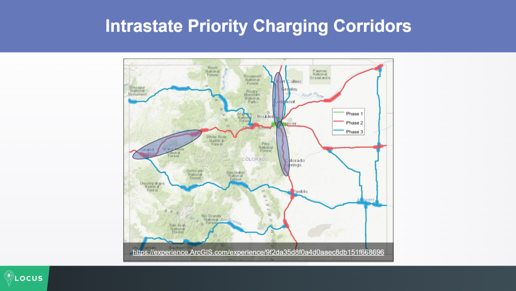
By combining the capabilities of LOCUS with the breadth of Altitude by Geotab’s data, there is tremendous value available for state organizations as they plan new freight infrastructure. Prior to transportation analytics, planners and modelers were largely in the dark about how to most efficiently move freight. Now, with a wealth of deeper insights available, departments can use data to create truly comprehensive plans for safer, smarter and more sustainable transportation systems.
Interested in learning more about the LOCUS partnership or how Altitude by Geotab can support upcoming state freight plans? Contact us to discover how our accurate and contextual insights can help your state develop smarter strategies.
States are required to update their strategic freight plans every four years per U.S. DOT mandate, and each plan must address 17 specific requirements — including current freight trends, truck parking assessments, supply chain analysis, multi-state compacts, and delay mitigation strategies. States receive federal funding in exchange for submitting a plan that covers all 17 areas along with how the funding will be used.
Platforms like LOCUS Truck (built on Geotab ITS’s commercial vehicle dataset) let planners study existing public and commercial parking lots and set up analysis zones to see where parking infrastructure currently stands. Site-level metrics — such as peak usage times, typical capacity limits, vehicle vocations/industries, and stop time distributions (how long vehicles rest and how trips break up) — help planners pinpoint exactly where new truck parking is most needed, as demonstrated in New Mexico’s case study.
Origin-and-destination trip data helps identify where commercial “middle mile” routes need charging support for fleets converting to electric trucks. In Colorado, this data showed that counties between Denver, Fort Collins, and Colorado Springs saw regular 75–125 mile trips followed by minimum 8-hour stops — signaling ideal spots for charging stations along heavy-freight corridors like I-70 and I-25.
LOCUS Truck is a freight planning and analytics tool developed by Cambridge Systematics, built using Geotab ITS’s extensive commercial vehicle dataset. It gives state departments a way to visualize holistic transportation data and evaluate how well their existing networks function, turning raw vehicle insights (travel patterns, vehicle types, parking trends) into actionable data for building smarter, more efficient freight infrastructure.
Truck parking planning made data-driven: Learn how DOTs use stop analytics to identify hot spots, justify funding and prioritize corridors.
Learn how commercial movement insights help fuel retailers build resilient networks ready for diesel, EV, and alternative fuels over the next decade.
Learn how observed commercial vehicle movement data helps fuel retailers win corridor competition through smarter site analysis and targeted strategy.