By Eric Schmidt, Senior Product Marketing Manager – Altitude by Geotab
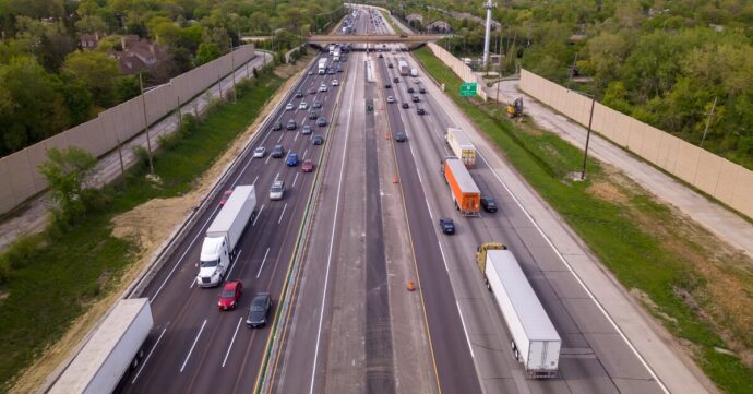
You know that feeling when you pull into a highway rest stop late at night and every space is full? At the Rail Splitter rest area on I-55 in Illinois, that was often the reality for commercial drivers.
In 2024, the Illinois Department of Transportation (IDOT) made the decision to close and fully rebuild the site. When it reopens in 2026, truck parking capacity will triple—from six to 18 spaces—with upgraded facilities and amenities. Read about the project here.
As someone who works with freight planners and transportation agencies every day, I was curious. This wasn’t a commissioned project, and I don’t speak on behalf of IDOT. But I wanted to independently explore what freight stop data could reveal about the conditions surrounding this kind of expansion—retrospectively and respectfully.

But raw volumes only tell part of the story. What stood out most was the level of overflow parking activity—trucks stopping outside official pads, particularly in the evening:
- Northbound pad: 3,171 stops
- Northbound overflow: 2,273 stops
- Southbound pad: 2,239 stops
- Southbound overflow: 1,598 stops
That’s 42% of all observed stops occurring in overflow areas—not just once or twice, but as a regular daily pattern. And this challenge is not unique to Illinois. It’s something I’ve seen echoed at rest areas across the U.S. and Canada: Where there’s limited space, demand spills over.

Why this expansion matters so much
Overflow is one thing. Timing is another.
After 6 p.m., the pressure on rest areas like the Rail Splitter climbs fast. Trucks keep arriving, and the average dwell time stretches into the overnight hours.
Truck stop events by time-of-day:
- 2 a.m. – 10 a.m.: 2,782 stops
- 10 a.m. – 6 p.m.: 4,421 stops (48% of all stops)
- 6 p.m. – 2 a.m.: 2,078 stops
Truck dwell time share by time-of-day:
- 2 a.m. – 10 a.m.: 16%
- 10 a.m. – 6 p.m.: 10%
- 6 p.m. – 2 a.m.: 73% of total dwell time

In short: the longest stops happened when capacity was most constrained, particularly in the early evening through the night. I modeled occupancy trends and saw multiple instances where the number of trucks stopping at the site likely outnumbered available spaces by several multiples.
Expanding to 18 spaces is absolutely the right move. It reduces the number of drivers forced to park on ramps or shoulders. And it addresses not just truck volume, but the behavior of trucks when parking capacity is unavailable—something that directly impacts safety, rest access and facility use.


What this taught me
The Rail Splitter example underscored something I’ve seen again and again in the data: Truck parking demand is measurable, predictable and deeply tied to stop behavior, not just volume.
By looking not only at when and where trucks stop, but also how long and under what conditions, we can more accurately forecast where infrastructure upgrades are most needed.
In this case, I was working alone—just using Altitude to see what the data could tell me. But the implications apply everywhere:
- Truck parking demand patterns can be detected before they escalate into safety risks or community complaints
- Stop duration and time-of-day behavior are just as critical as stop counts
- Corridor-wide insights, not just site-specific metrics, are essential for effective planning

A call to action
To IDOT: I applaud your decision to invest in Rail Splitter’s expansion. It’s an important step forward, and I look forward to seeing the site reopen in 2026.
To other transportation agencies across North America: “What opportunities are hiding in your network to improve truck parking availability?how many Rail Splitters are hiding in your network today?
This kind of analysis doesn’t require speculation—it requires stop-level insight.
Close freight planning and truck parking gaps with Altitude
Proper truck parking is a critical aspect for effective freight planning, as it enables drivers to stay safer while they tirelessly move our goods. However, parking options that can accommodate commercial vehicles are often scarce. Research shows that 98% of U.S. truck drivers regularly report issues with locating safe parking. Furthermore, it’s estimated that only one parking space is available per 11 truck drivers. To solve these systemic problems, a highly targeted and data-driven approach is required; one that Altitude by Geotab can support.
What sets the Altitude platform apart is our ability to analyze not just truck movement, but stop behavior—how long, where and when commercial vehicles stop across the entire road network.
- We go beyond GPS dots. We contextualize commercial stops across 99.9% of primary roadways.
- We segment stops by vehicle class, time-of-day, and corridor usage.
- We provide Expansion Factors and historical baselines to scale observed behavior with confidence.
- We help agencies prioritize investments, redesign rest areas and optimize freight networks.
Through our real-world truck parking and mobility insights, you can go beyond assumptions, supporting your freight planning initiatives with evidence of what trucks are actually doing. Altitude by Geotab is ready to partner with you to identify truck parking deficiencies, surface broader commercial movement trends and advance your freight planning objectives. Reach out to us today to learn more about how we can help you reach your transportation goals.