Building confidence in traffic data: The development of Expansion Factors
Learn more about expansion factors with Altitude by Geotab and how they enable organizations to enhance their transportation networks.

We’re thrilled to introduce Altitude’s Beta Participation Program—a collaborative initiative aimed at co-creating innovative solutions to address the evolving needs of the transportation industry. As we embark on this journey together, our goal is simple: to provide you with the tools and insights you need to drive positive change in your organizations and communities.
Participating in Altitude’s Beta Program is about more than just testing new features—it’s an opportunity to contribute to a shared vision of making transportation safer, more efficient, and sustainable for all. Here’s why your involvement matters:
Altitude’s Beta Program is open to all current customers and users as well as consultants and integration platform partners. Altitude caters to the needs of the following:
If you’re not currently active users or customers, reach out to us, and we may be able to help you uncover the value of the beta features in exchange for your expert feedback and industry knowledge based on who you are and what you know.
Participating in Altitude’s Beta Program is easy:

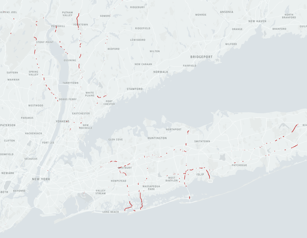
“Visualizing Harsh Event Occurrences in New York 2023: Highlighting the Top 0.1% of Locations, Signifying Potential High-Risk and Accident-Prone Roadways. This information is presented within the Dekart platform for illustrative purposes only.”
Road safety is a top concern, with initiatives like Vision Zero emphasizing the urgency of preventing collisions. The Altitude team believes that waiting until a collision occurs to understand road safety is not sufficient to prevent collisions. That’s why we’re exploring how Harsh Events in driving could serve as an early warning system to detect signs of potential danger before accidents happen. Join our beta program to explore how harsh braking, acceleration, and cornering events correlate with unsafe road segments. By participating in our beta, you’ll play a vital role in our mission to make roads safer.

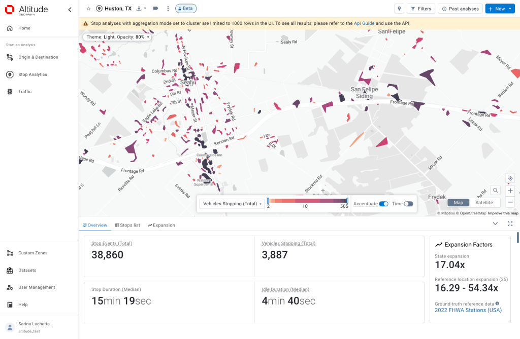
The Stop Analytics with Clusters feature aggregates movement and stopping data to group similar patterns, enhancing data visualization and analysis. This innovative functionality clusters activities based on activity volume rather than shapes, streamlining user interaction and interpretation. Explore and analyze where stopping occurs on road networks, areas needing efficiency improvements at intersections, or locations where stop occurrences on arterial roads, highways, and interstates should be minimized. Test Stop Analytics Clusters and share your thoughts with our Product Team to help us tailor this feature to your needs.
At Altitude, we’re committed to providing as much value as possible to our clients and partners. By participating in our Beta Program, you’re not just testing new features—you’re helping us build a brighter future for transportation together.
A Note on Beta Testing: Beta testing is a phase where we test, validate, and solve problems. It serves to preview features, retain customers, engage with users, and add value. Beta testers play a crucial role in refining our offerings and ensuring stability before full release. Your feedback ensures the software performs well in diverse conditions and meets your high standards.
Thank you for your partnership and collaboration,
Eric Schmidt, Senior Product Marketing Manager
Geotab ITS Altitude Team
Learn more about expansion factors with Altitude by Geotab and how they enable organizations to enhance their transportation networks.
Learn more about our expanded trip chaining options within the Geotab ITS Altitude platform which allows more custom analysis for users.
Altitude by Geotab’s platform unveils new vocation classifications to gain understanding of vehicles’ purpose on the road.