Commercial vehicle AADT: the most accurate estimates at national scale
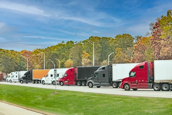
This heavy-duty truck volume analysis shows how toll pricing differences reshape freight corridor behavior at the US-Canada border.


Freight corridors help to keep a city, region or country thriving. So naturally, transportation activity is intertwined with economic performance (as illustrated in the Transportation Services Index vs GDP chart). With this correlation in mind, observing trends in freight and goods movement can be a window into how well, or how poorly, an economy is growing.
And it’s not all big picture either – there’s immense potential for insight into economic growth on the regional or city level. By measuring freight and goods movement, you can tell a lot about how the different economies of a district, city or country are performing. Here are just a few of the ways that freight and goods movement can indicate the health of an economy.

The most fundamental example of this is measuring the sheer quantity of freight and goods movement coming out of ports to your city or region. The higher the volume, the healthier an economy tends to be. And by drilling down further, you can uncover even more valuable insights. Analyzing vehicle industry, vehicle vocation, which port the vehicle is originating from and what their final destination is can help you understand why the economy is performing the way it is.
If you have access to the right insights, burgeoning supply chain disruptions can also show up as patterns in transportation data. Analyzing port freight can help provide an early warning for bottlenecks: If the number of commercial vehicles is increasing towards an unsustainable level, you may have to consider increasing the capacity of your road infrastructure, or risk damaging your region’s economy.
Intelligent data can also shed light on how your cities and counties interact with each other. By analyzing city-to-city freight volume, you can begin to see how two particular economies are interconnected and co-dependant, and how economic growths and stagnancies between cities are correlated. This means you can uncover which cities act as the final destination for economy-boosting transactions, and which cities or counties are important hubs for freight storage and distribution, then use this information to invest accordingly.
You’ll also be able to differentiate between heavy-duty vehicles moving large quantities of goods from ports to warehouses, and lighter vehicles that are making last-mile deliveries. This will empower you to make the right investments to increase efficiency in city-to-city and county-to-county travel. For example, if a particular city is experiencing a relatively large amount of last-mile traffic, you might consider investing in multiple routes into the city center. Whereas if the traffic is dominated by heavy-duty vehicles delivering large volumes of freight, you may consider focusing your investments in your main corridors that lead to suburban warehouses.

Here’s a bit of a thought experiment: what kind of infrastructure decisions could you make if you had a near real-time, fresh breakdown of freight activity in your city? Being able to analyze that intra-city activity into industry categories could give you valuable insight into the fastest growing or highest generating industries, or neighborhoods, of the moment.
Alongside this, you could analyze whether there are more distribution centers or hubs popping up in certain zip codes or Traffic Analysis Zones (TAZs) of a city. From there, you can make policy decisions that support this change and help to grow your economy.
You would also be able to track and understand the ripple effect of industry closures on commercial activity at a deeper level. This information will give you the insight you need to consider whether you should be offering incentives to particular industries to encourage them to return to your region. States like Ohio have demonstrated that this can be a particularly effective way to stimulate growth – generating significant ROI from their incentive investments.
The dynamics of intra- and inter-city freight transportation can shed valuable light on economic performance – and help you support your economy. This is especially true when you analyze freight movement within the context of macro patterns. But to achieve this, you need to be able to collect and analyze the relevant data.
Enter Altitude by Geotab. Whether you want to analyze specific days of the week, times of day, the different industries traveling through your region or the impact of the type of vehicles themselves, Altitude empowers you with near real-time data.
It provides DOTs with a living dashboard of near real-time transportation data and the toolset to easily parse, analyze and act upon that insight. All this means it’s an exciting time to be in the transportation planning industry. Learn more about how Altitude can help you make smarter, impactful decisions here.
This heavy-duty truck volume analysis shows how toll pricing differences reshape freight corridor behavior at the US-Canada border.
This heavy-duty truck volume analysis shows how toll pricing differences reshape freight corridor behavior at the US-Canada border.
Altitude by Geotab and CATT Lab bring Stop Analytics into RITIS, giving DOTs and MPOs access to observed truck stop data from 6 million commercial vehicles.