Skip to Main Content
Two workers wearing high-visibility vests and hard hats stand outdoors at dusk, discussing or inspecting a site. One worker, wearing an orange helmet, holds a laptop, while the other, wearing a white helmet, points into the distance towards blurred industrial structures illuminated in the background.

Grid Impact Planning

Forecast where commercial customers require service upgrades for EV charging.

Amplify your grid plan for EV adoption

Electric utilities will need to handle the increased demand as large commercial customers electrify their fleets and install charging infrastructure at various depots. Planning where supply will need to meet demand can be challenging without knowing where commercial fleets are likely to charge. Altitude provides the ability to forecast increased electrical demands from commercial fleets, highlighting where utility upgrades will be needed. With this information, electric utilities gain powerful insights to better plan for future customer needs and locate optimal sites within cities, across states or along highways.

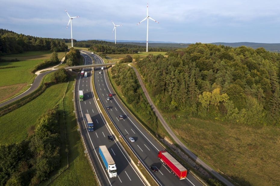
An aerial view of a rest area for trucks located near a highway, surrounded by lush green trees and fields. Multiple semi-trucks with trailers are parked in organized rows within the designated parking area, while others wait along a nearby road. The scene includes a highway in the background with vehicles in motion, connecting to curved access roads leading to the rest stop.

Find the best locations for EV charging depots

Drive better outcomes with more useful insights from more comprehensive and more granular insights than general distance traveled data by using aggregate commercial vehicle data to support demand plans.

Altitude provides reliable forecasts on where commercial fleets will need new or upgraded infrastructure, allowing electric utilities to efficiently handle the growing demand as large commercial customers electrify their fleets.

Identify the best locations for charging infrastructure within cities, across states or along highways. This allows utilities, DOTs, municipal planners and charging service companies to strategically deploy resources where they are most needed.

Using granular data on vehicle stop and domicile locations, Altitude helps utilities accurately predict where automotive fleet customers are likely to require service upgrades, reducing uncertainty and planning gaps.

Altitude connects electric utilities to powerful insights, enabling scenario planning to anticipate future customer requirements. This promotes effective supply-demand matching, accommodating improvement in technology such as greater driving range and faster charge times.

As the primary source and processor of mobility data from over four million commercial vehicles across North America, Altitude prioritizes the reliability, confidentiality and privacy of the data, enhancing the effectiveness of your planning efforts.

Forecast charging demand

Use contextual insights into commercial vehicle charging needs through advanced tools to enhance your ability to develop robust grid infrastructure.

Stop Analytics Module

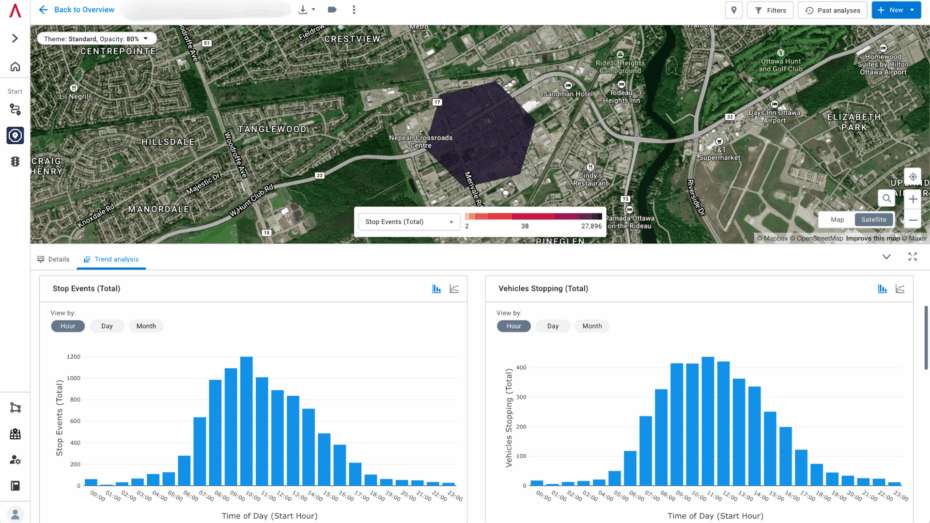
Gain insights into vehicle stop patterns to identify optimal locations for alternative fuel refilling and commercial charging stations. This module provides detailed metrics into aggregate vehicle stop patterns segmentable by class, fuel type, vocation and stop duration.

Regional Domicile Analytics

Identify areas likely to electrify based on commercial vehicle movement patterns. This module helps utilities forecast where charging infrastructure is needed by providing insights into commercial vehicle electrification viability.

Regional Travel Metrics Module

This module provides essential metrics, such as modeled Average Annual Daily Traffic (AADT) and vehicle miles/ kilometers traveled (VMT/ VKT), to forecast where commercial vehicles may need refueling and charging. It helps understand vehicle travel patterns and characteristics, supporting strategic planning for grid electrification.

Expansion Factors

See beyond distance traveled data to breakdown traffic volume with context into market representative heavy, medium and all commercial and non-commercial vehicles for Motorway, Primary, Secondary, Tertiary and Trunk road segments, promoting effective planning and deployment of charging infrastructure.

About the Altitude platform

Altitude by Geotab provides reliable and contextualized mobility insights for public and commercial sector decision-makers to gain a complete understanding of movements across road networks.

This enables our customers to achieve improved planning capabilities as well as better financial outcomes, without the challenge of finding trustworthy and usable data sets.

As the primary source and processor of mobility data, we prioritize complete confidentiality and privacy while maintaining the full context of vehicle movements.

An aerial view of an electrical substation featuring a complex network of power lines, transformers, and metal frameworks arranged in a grid-like pattern. The site includes several large utility structures, such as a covered building and rows of equipment, spread across a gravel-covered area. The symmetrical arrangement of components and overhead wiring emphasizes the technical precision of the facility, showcasing its role in power distribution and infrastructure.

Altitude elevates grid planning

Book a demo to discover how you can identify where large commercial customers are likely to require new or upgraded service to support fleet charging.